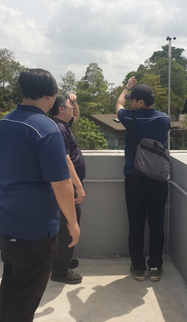
The landscape of adventure tourism in Singapore is reaching new elevations with the expansion of the Mandai Rainforest Wild Adventure. As the park introduces its highly anticipated adventurous zones, including the exhilarating Rainforest Wild Asia Free Fall Tower, guest safety remains the cornerstone of operations. We are pleased to announce the successful testing and commissioning of the Navis Wireless Anemometer System, a state-of-the-art Wind Speed Monitoring System designed to ensure peak safety for all visitors.
The Critical Role of Wind Speed Monitoring System in Adventure Parks
Enhancing Safety with the Wind Speed Monitoring System
The implementation of a Wind Speed Monitoring System is essential in maintaining the safety and enjoyment of all park activities.
In an environment where guests experience high-altitude drops and canopy-level thrills, wind is more than just a breeze—it is a critical safety variable. Strong or unpredictable gusts can impact the trajectory of a free fall or the stability of harnessed attractions. The implementation of a Wind Speed Monitoring System is essential for maintaining safety standards.
The Navis system serves as the park’s “digital eyes” on the atmosphere. By providing real-time data, it empowers park operators to make split-second, informed decisions. If wind speeds exceed pre-set safety thresholds, the wind speed alert system triggers immediate notifications, allowing staff to pause attractions until conditions stabilize.
Project Milestone: Testing and Commissioning
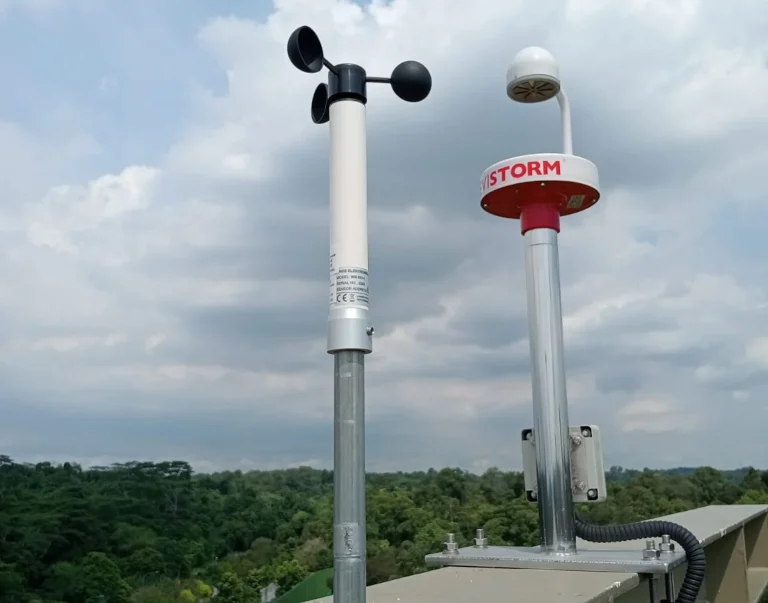
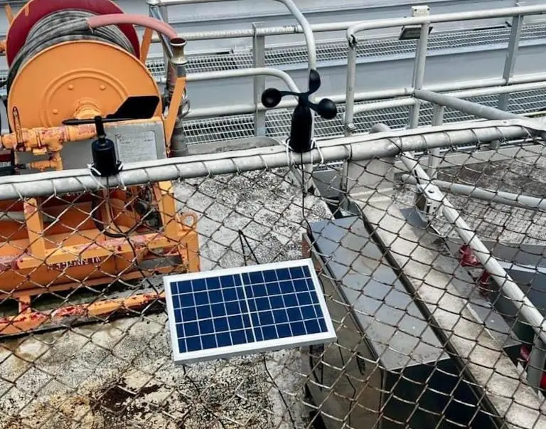
The decision to implement a wireless solution at Mandai Rainforest Wild Adventure Safari was driven by the need for precision and flexibility in a complex, lush environment.
- Long-Range Connectivity: With a transmission range of up to 1,300 meters, the Navis sensors can be placed at the most exposed, highest points of the park while communicating seamlessly with the control center.
- Real-Time Data Transmission: Data is refreshed every 2 seconds, ensuring that the safety team is never working with outdated information.
- Weather-Resistant Durability: Built with high-quality materials and precision bearings, the anemometers are designed to withstand Singapore’s tropical humidity and heavy rain.
- Minimal Environmental Impact: The wireless nature of the system eliminated the need for invasive cabling through the protected rainforest terrain, preserving the natural habitat of the nocturnal animals.
Why the Navis Wireless Wind Speed Monitoring System?
The decision to implement a wireless solution at Mandai Rainforest Wild Adventure Safari was driven by the need for precision and flexibility in a complex, lush environment.
- Long-Range Connectivity: With a transmission range of up to 1,300 meters, the Navis sensors can be placed at the most exposed, highest points of the park while communicating seamlessly with the control center.
- Real-Time Data Transmission: Data is refreshed every 2 seconds, ensuring that the safety team is never working with outdated information.
- Weather-Resistant Durability: Built with high-quality materials and precision bearings, the anemometers are designed to withstand Singapore’s tropical humidity and heavy rain.
- Minimal Environmental Impact: The wireless nature of the system eliminated the need for invasive cabling through the protected rainforest terrain, preserving the natural habitat of the nocturnal animals.
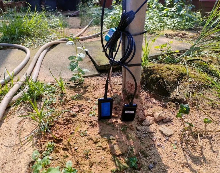
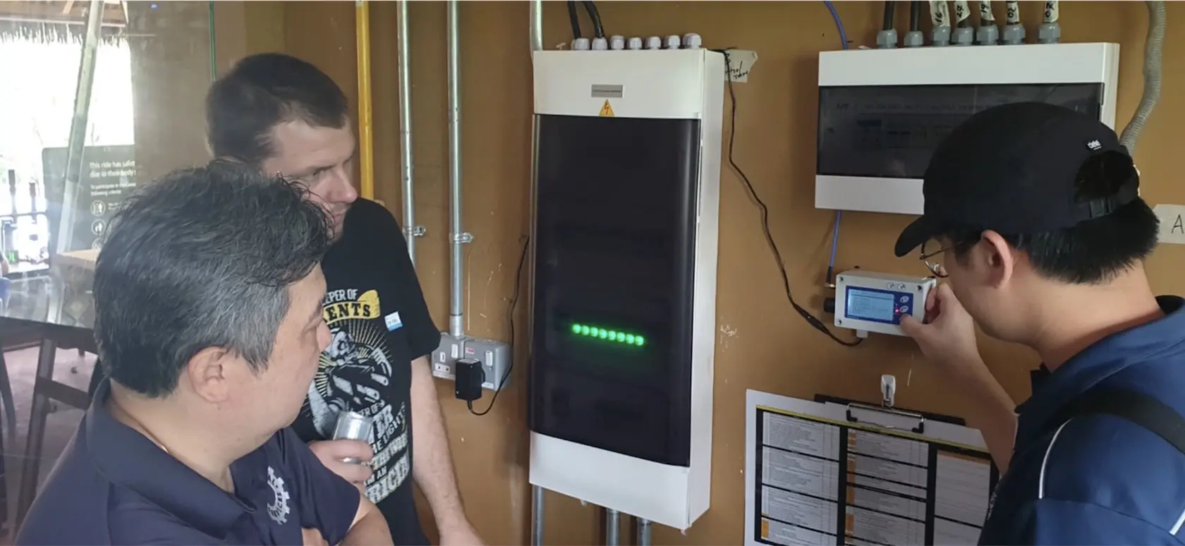
The commissioning process involved rigorous stress-testing to ensure the system’s reliability under various meteorological conditions. Our engineers focused on three key areas:
- Signal Integrity: Ensuring the 868 MHz/915 MHz frequency remained stable despite the dense canopy and undulating terrain of the Mandai area.
- Alarm Calibration: Setting precise multi-level alerts—yellow for “Pre-Alarm” (cautionary) and red for “Main Alarm” (immediate action).
- Integration: Syncing the sensor data with the park’s central safety dashboard for centralized monitoring.
“The successful deployment of the Navis system at the Free Fall Tower marks a significant milestone in our commitment to ‘Safety First’ adventure. We are proud to provide the technology that allows guests to chase thrills with total peace of mind.” — Project Lead, GMM Technoworld.
Technical Specifications at a Glance
| Feature | Specification |
| Measurement Range | 0.6 m/s – 50.0 m/s |
| Data Refresh Rate | Every 2 Seconds |
| Battery Life | Up to 4 Years (Sensor) |
| Connectivity | Wireless (Up to 1.3km) |
| Mounting | Self-leveling magnetic assembly |
Elevating the Visitor Experience
As Mandai Wildlife Reserve continues to innovate, the inclusion of the Navis Wireless Anemometer ensures that the “Wild” in Rainforest Wild Adventure remains exciting yet controlled. Whether you are plunging from the Free Fall Tower or navigating the high-rope karts, the invisible protection of our wind monitoring technology is always at work.
This project underscores a vital truth in modern tourism: the best adventures are the ones where safety is so seamless, it’s almost invisible.
How to monitor wind speeds?
To monitor wind speeds, you can use an anemometer, which measures wind speed and direction. Alternatively, you can access local weather stations or use weather apps and websites that provide real-time wind speed data. For specific regions, consider using tools like NOAA’s National Weather Service or specialized weather services like Weather Underground.
Can I use my phone to measure wind speed?
Yes, you can use your phone to measure wind speed by downloading a weather app that includes wind speed features or using an anemometer app. Some apps utilize your phone’s sensors for this purpose.
What device can measure wind speed?
An anemometer.
Which device helps monitor wind speed?
An anemometer helps monitor wind speed.